National Register of Historic Places listings in Northeast Quadrant, Washington, D.C.
Appearance
This is a list of properties and districts in the Northeast quadrant of Washington, D.C. that are listed on the National Register of Historic Places.
This National Park Service list is complete through NPS recent listings posted November 8, 2024.[1]
Current listings
[edit]| [2] | Name on the Register | Image | Date listed[3] | Location | City or town | Description |
|---|---|---|---|---|---|---|
| 1 | American Revolution Statuary |  |
July 14, 1978 (#78000256) |
Public buildings and various parks within DC 38°53′37″N 76°59′59″W / 38.893611°N 76.999722°W | Stanton Park | 14 statues including 11 in central DC, and the General Nathanael Greene statue in Stanton Park |
| 2 | Atlas Theater and Shops | 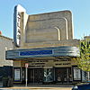 |
November 10, 2010 (#10000909) |
1313-33 H Street, NE 38°53′59″N 76°59′15″W / 38.899722°N 76.9875°W | Near Northeast | |
| 3 | Mountjoy Bayly House |  |
July 20, 1973 (#73002072) |
122 Maryland Ave., NE 38°53′29″N 77°00′18″W / 38.891389°N 77.005°W | Capitol Hill | |
| 4 | Brookland Bowling Alleys |  |
August 19, 2019 (#100004306) |
3726 10th St. NE. 38°56′10″N 76°59′36″W / 38.9362°N 76.9933°W | Brookland | |
| 5 | Brooks Mansion |  |
July 17, 1975 (#75002045) |
901 Newton St., NE. 38°55′58″N 76°59′37″W / 38.932778°N 76.993611°W | Brookland | |
| 6 | Ralph Bunche House |  |
September 30, 1993 (#93001013) |
1510 Jackson St., NE. 38°55′47″N 76°59′02″W / 38.929722°N 76.983889°W | Brookland | |
| 7 | Bunker Hill Elementary School |  |
May 5, 2014 (#14000186) |
1401 Michigan Ave., NE 38°56′31″N 76°59′06″W / 38.942004°N 76.984969°W | Brookland | |
| 8 | Capitol Hill Historic District |  |
August 27, 1976 (#76002127) |
Roughly bounded by Virginia Ave., SE., S. Capitol St., F St., NE., and 14th Sts., SE. and NE.; also roughly bounded by 7th St., NE., I-295, M St., SE., and 11th St., SE. 38°53′13″N 76°59′51″W / 38.886944°N 76.9975°W | NE, SE and NW | Second set of boundaries represents a boundary increase of July 3, 2003 |
| 9 | Chesapeake and Potomac Telephone Company Warehouse and Repair Facility |  |
May 14, 2007 (#06001159) |
1111 N. Capitol St. NE 38°54′15″N 77°00′32″W / 38.9043°N 77.009°W | NE | |
| 10 | Children's Country Home |  |
December 9, 2003 (#03001254) |
1731 Bunker Hill Rd. NE 38°56′29″N 76°58′39″W / 38.941389°N 76.9775°W | Woodridge | |
| 11 | Civil War Fort Sites |  |
July 15, 1974 (#74000274) |
Arc of sites surrounding central Washington in Maryland, Virginia, and D.C. 38°56′08″N 76°59′15″W / 38.935509°N 76.987628°W | All quadrants | At the outset of the Civil War in 1861, Washington became a critical target for rebel attacks but was virtually without protection. The Union Army hastily began construction of a fortified defense line around the city, the physical remnants of which encompass these 19 earthwork forts, including Fort Totten, Fort Bunker Hill, Fort Lincoln, and Fort Mahan.[4] See also National Register listings in central D.C., western NW D.C., upper NW D.C., SE D.C., Prince George's County, Maryland, and Fairfax County, Virginia. |
| 12 | Civil War Monuments in Washington, DC | 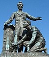 |
September 20, 1978 (#78000257) |
Various parks within the original boundaries of city 38°53′23″N 76°59′25″W / 38.889722°N 76.990278°W | Various | 18 statues about people and topics related to the Civil War, including 1 in Lincoln Park (NE & SE quadrants), 6 in the upper NW quadrant, and 11 in central Washington. |
| 13 | Alexander Crummell School |  |
July 25, 2003 (#03000671) |
Kendall and Gallaudet Sts, NE 38°54′48″N 76°59′07″W / 38.913333°N 76.985278°W | NE | |
| 14 | Dahlgreen Courts |  |
November 10, 2010 (#10000901) |
2504-2520 10th St., NE 38°55′22″N 76°59′34″W / 38.922778°N 76.992778°W | Brookland | Apartment Buildings in Washington, DC, MPS |
| 15 | East Capitol Street Carbarn |  |
February 5, 1974 (#74002158) |
1400 E. Capitol St., NE. 38°53′23″N 76°59′06″W / 38.889722°N 76.985°W | NE | |
| 16 | East Corner Boundary Marker of the Original District of Columbia |  |
November 1, 1996 (#96001249) |
100 ft. E of jct. of Eastern and Southern Aves. 38°53′35″N 76°54′34″W / 38.893056°N 76.909444°W | NE and SE | See List of Boundary Markers of the Original District of Columbia
Eastern High School, 1730 East Capitol Street NE, Washington, MP100009489, LISTED, 10/30/2023 |
| 17 | Eastern High School |  |
October 30, 2023 (#100009489) |
1730 East Capitol Street NE 38°53′48″N 76°59′13″W / 38.896725°N 76.986907°W | NE | |
| 18 | Emerald Street Historic District |  |
September 5, 2017 (#100001560) |
1307-1377, 1306-1368 Emerald St. NE., 517-519 13t St. NE., 518-520 14th St. NE. 38°53′48″N 76°59′13″W / 38.896725°N 76.986907°W | NE | |
| 19 | Engine House No. 10 |  |
November 19, 2008 (#08001063) |
1341 Maryland Ave., NE 38°53′54″N 76°59′13″W / 38.898364°N 76.986866°W | NE | |
| 20 | Engine Company 17 |  |
June 6, 2007 (#07000538) |
1227 Monroe St. NE[5] 38°55′56″N 76°59′24″W / 38.932222°N 76.990000°W | Brookland | |
| 21 | Engine Company 26 |  |
May 18, 2011 (#11000283) |
1340 Rhode Island Ave., NE 38°55′29″N 76°59′12″W / 38.924722°N 76.986667°W | Brentwood/ Brookland | Firehouses in Washington DC MPS |
| 22 | Engine Company 26, (Old) |  |
August 8, 2007 (#07000536) |
2715 22nd St. NE 38°55′30″N 76°58′27″W / 38.925°N 76.974167°W | NE | |
| 23 | Engine Company 27 |  |
May 18, 2011 (#11000284) |
4201 Minnesota Ave., NE 38°54′04″N 76°56′36″W / 38.901111°N 76.943333°W | NE | Firehouses in Washington DC MPS |
| 24 | First Baptist Church of Deanwood |  |
July 24, 2008 (#08000720) |
1008 45th St. NE 38°54′11″N 76°56′17″W / 38.903119°N 76.938°W | Deanwood | |
| 25 | Franciscan Monastery and Memorial Church of the Holy Land |  |
January 17, 1992 (#91001943) |
1400 Quincy St., NE. 38°56′13″N 76°59′00″W / 38.936944°N 76.983333°W | Brookland | |
| 26 | Gallaudet College Historic District |  |
October 15, 1966 (#66000856) |
Florida Ave. and 7th St., NE. 38°54′22″N 76°59′45″W / 38.906111°N 76.995833°W | NE | |
| 27 | Glenwood Cemetery |  |
January 17, 2017 (#16000638) |
2219 Lincoln Rd., NE 38°55′18″N 77°00′20″W / 38.921651°N 77.005488°W | NE | |
| 28 | Glenwood Cemetery Mortuary Chapel |  |
January 9, 1989 (#88003064) |
2219 Lincoln Rd., NE 38°55′19″N 77°00′22″W / 38.921944°N 77.006111°W | NE | |
| 29 | Harewood Lodge |  |
May 20, 2019 (#100003672) |
3600 Harewood Rd. NE. 38°55′57″N 77°00′05″W / 38.9326°N 77.0014°W | NE | |
| 30 | Hecht Company Warehouse |  |
May 25, 1994 (#94000446) |
1401 New York Ave., NE. 38°54′52″N 76°59′06″W / 38.914444°N 76.985°W | NE | |
| 31 | Holy Redeemer College |  |
May 17, 2019 (#100003958) |
3112 Seventh St. NE 38°55′44″N 76°59′48″W / 38.9288°N 76.9967°W | NE | |
| 32 | Kenilworth Aquatic Gardens |  |
August 25, 1978 (#78000258) |
Kenilworth Ave. and Douglas St. NE 38°54′46″N 76°56′37″W / 38.912778°N 76.943611°W | NE | |
| 33 | Kingman Park Historic District |  |
December 17, 2018 (#100002960) |
Between Rosedale & D St., Maryland Ave. NE, 19th St. & Oklahoma Ave. NE; also 900-2000 blks. of C, D and E Sts. NE; 300 and 400 blks. of 19th and 20th Sts. NE 38°53′44″N 76°58′28″W / 38.8956°N 76.974494°W | Kingman Park | Second set of addresses represent a boundary increase approved April 22, 2021. |
| 34 | Langston Golf Course Historic District |  |
October 15, 1991 (#91001525) |
Roughly, Anacostia Park N of Benning Rd. NE 38°54′08″N 76°57′54″W / 38.902222°N 76.965°W | NE | |
| 35 | Langston Terrace Dwellings |  |
November 12, 1987 (#87001851) |
N from Benning Rd. to H St., NE 38°53′58″N 76°58′26″W / 38.899444°N 76.973889°W | Langston | |
| 36 | The Lexington |  |
January 19, 2016 (#15000978) |
1114 F St., NE 38°53′51″N 76°59′28″W / 38.897570°N 76.991040°W | Near Northeast | |
| 37 | Mayfair Mansions Apartments |  |
November 1, 1989 (#89001735) |
3819 Jay St., NE 38°54′11″N 76°56′55″W / 38.903056°N 76.948611°W | Mayfair | |
| 38 | Metropolitan Apartments |  |
May 12, 2014 (#14000199) |
200-210 Rhode Island Ave., NE. 38°55′09″N 77°00′12″W / 38.919253°N 77.003327°W | Edgewood | |
| 39 | Newton Theater |  |
June 27, 2007 (#07000592) |
3601-3611 12th St. NE 38°56′08″N 76°59′27″W / 38.935556°N 76.990833°W | Brookland | |
| 40 | Northeast No. 3 Boundary Marker of the Original District of Columbia | 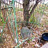 |
November 1, 1996 (#96001256) |
144 ft. NW of jct. of Eastern Ave. and Chillum Rd. 38°57′55″N 77°00′06″W / 38.965271°N 77.001750°W | NE | |
| 41 | Northeast No. 4 Boundary Marker of the Original District of Columbia |  |
November 1, 1996 (#96001255) |
5400 Sargent Rd. 38°57′17″N 76°59′17″W / 38.954722°N 76.988056°W | NE | |
| 42 | Northeast No. 5 Boundary Marker of the Original District of Columbia |  |
November 1, 1996 (#96001254) |
4609 Eastern Ave. 38°56′39″N 76°58′28″W / 38.9442°N 76.9744°W | NE | |
| 43 | Northeast No. 6 Boundary Marker of the Original District of Columbia | 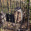 |
November 1, 1996 (#96001253) |
3601 Eastern Ave. 38°56′01″N 76°57′41″W / 38.9336°N 76.9614°W | NE | |
| 44 | Northeast No. 7 Boundary Marker of the Original District of Columbia |  |
November 1, 1996 (#96001252) |
Ft. Lincoln Cemetery 38°55′26″N 76°56′56″W / 38.9239°N 76.9489°W | NE | |
| 45 | Northeast No. 8 Boundary Marker of the Original District of Columbia | 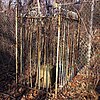 |
November 1, 1996 (#96001251) |
Kenilworth Aquatics Gardens, NW of jct. of Eastern and Kenilworth Aves. 38°54′50″N 76°56′10″W / 38.9139°N 76.9361°W | NE | |
| 46 | Northeast No. 9 Boundary Marker of the Original District of Columbia |  |
November 1, 1996 (#96001250) |
919 Eastern Ave. 38°54′12″N 76°55′21″W / 38.9033°N 76.9225°W | NE | |
| 47 | Northeast Savings Bank |  |
December 28, 2023 (#100009657) |
800 H Street, NE 38°54′01″N 76°59′41″W / 38.9003°N 76.9947°W | NE | |
| 48 | Plymouth Theater |  |
March 3, 2004 (#04000117) |
1365 H St., NE 38°54′07″N 76°59′11″W / 38.9019°N 76.9864°W | NE | |
| 49 | President's House, Gallaudet College |  |
February 15, 1974 (#74002172) |
7th St. and Florida Ave., NE. 38°54′19″N 76°59′46″W / 38.9053°N 76.9961°W | NE | |
| 50 | Roosevelt Apartment Building |  |
September 7, 1994 (#94001045) |
1116-1118 F St., NE. 38°53′50″N 76°59′27″W / 38.8972°N 76.9908°W | Near Northeast | |
| 51 | St. Joseph's Seminary |  |
September 28, 2022 (#100008232) |
1200 Varnum St. NE. 38°56′37″N 76°59′21″W / 38.9436°N 76.9893°W | NE | |
| 52 | St. Paul's College |  |
September 13, 2018 (#100002913) |
3015 4th St. NE. 38°55′41″N 76°59′56″W / 38.928°N 76.9988°W | NE | |
| 53 | Schlitz Brewing Company Washington Branch and National Geographic Society Warehouse |  |
January 3, 2023 (#100008512) |
326 R St. NE. 38°54′46″N 77°00′06″W / 38.9127°N 77.0018°W | Eckington | |
| 54 | Sewall–Belmont House National Historic Site |  |
June 16, 1972 (#72001432) |
144 Constitution Ave., NE. 38°53′32″N 77°00′14″W / 38.8922°N 77.0039°W | NE | |
| 55 | Slowe-Burrill House |  |
October 5, 2020 (#100005324) |
1256 Kearny St. NE. 38°55′51″N 76°59′20″W / 38.9307°N 76.9890°W | Brookland | |
| 56 | Lucy Diggs Slowe Elementary School |  |
December 20, 2021 (#100007259) |
3115 14th St. NE and 1404 Jackson St. NE. 38°55′45″N 76°59′10″W / 38.9293°N 76.9862°W | ||
| 57 | Smothers Elementary School | June 23, 2023 (#100009057) |
4400 Brooks St. NE 38°53′37″N 76°56′18″W / 38.8935°N 76.9384°W | |||
| 58 | Spingarn Senior High School |  |
May 12, 2014 (#14000198) |
2500 Benning Rd., NE. 38°53′58″N 76°58′15″W / 38.8995°N 76.9709°W | Carver Langston | |
| 59 | Strand Theater |  |
November 25, 2008 (#08001093) |
5129-5131 Nannie Helen Burroughs Ave., NE 38°53′54″N 76°55′34″W / 38.8983°N 76.9261°W | NE | |
| 60 | Trades Hall of National Training School for Women and Girls |  |
July 17, 1991 (#91002049) |
601 50th St., NE. 38°53′46″N 76°55′48″W / 38.8961°N 76.93°W | NE | |
| 61 | Truck House No. 13 |  |
June 6, 2007 (#07000535) |
1342 Florida Ave. NE 38°54′05″N 76°59′13″W / 38.9014°N 76.9869°W | NE | |
| 62 | U.S. National Arboretum |  |
April 11, 1973 (#73002122) |
24th and R Sts., NE. 38°54′42″N 76°57′58″W / 38.9117°N 76.9661°W | NE | |
| 63 | U.S. Post Office Department Mail Equipment Shops |  |
July 11, 2016 (#16000435) |
2135 5th St., NE 38°55′08″N 76°59′58″W / 38.9190°N 76.9995°W | Eckington | |
| 64 | Uline Ice Company Plant and Arena Complex |  |
May 17, 2007 (#07000448) |
1132, 1140, and 1146 3rd St. NE 38°54′18″N 77°00′11″W / 38.905°N 77.0031°W | Near Northeast | |
| 65 | Union Market Historic District |  |
January 31, 2017 (#100000596) |
Between 4th and 5th Sts. NE., and Florida Ave. and Penn St., NE. 38°54′30″N 76°59′57″W / 38.9083°N 76.9992°W | NE | |
| 66 | Union Station |  |
March 24, 1969 (#69000302) |
Intersection of Massachusetts and Louisiana Aves. and 1st St., NE. 38°53′51″N 77°00′23″W / 38.8975°N 77.0064°W | NE | |
| 67 | Union Station Plaza and Columbus Fountain |  |
April 9, 1980 (#80004523) |
1st St., Massachusetts and Louisiana Aves., NE 38°53′47″N 77°00′23″W / 38.8964°N 77.0064°W | NE | |
| 68 | United Brick Corporation Brick Complex |  |
October 3, 1978 (#78003061) |
2801 New York Ave., NE. 38°54′58″N 76°58′06″W / 38.9161°N 76.9683°W | NE | |
| 69 | Woodward & Lothrop Service Warehouse |  |
February 15, 2005 (#05000046) |
131 M St. NE 38°54′25″N 77°00′17″W / 38.9069°N 77.0047°W | Near Northeast | |
| 70 | Young, Browne, Phelps and Spingarn Educational Campus Historic District |  |
May 3, 2016 (#15000743) |
2500 Benning Rd., NE., 704, 820, & 850 26th St., NE 38°54′00″N 76°58′15″W / 38.9001°N 76.9708°W | NE |
References
[edit]- ^ National Park Service, United States Department of the Interior, "National Register of Historic Places: Weekly List Actions", retrieved November 8, 2024.
- ^ Numbers represent an alphabetical ordering by significant words. Various colorings, defined here, differentiate National Historic Landmarks and historic districts from other NRHP buildings, structures, sites or objects.
- ^ The eight-digit number below each date is the number assigned to each location in the National Register Information System database, which can be viewed by clicking the number.
- ^ Dillon, James (July 30, 1976), National Register of Historic Places Inventory — Nomination Form for Federal Properties: Defenses of Washington (Civil War) (PDF), archived (PDF) from the original on February 15, 2017, retrieved February 18, 2019.
- ^ District of Columbia Fire Department. "DC FEMS Fire Station Locations". Archived from the original on 2009-12-10. Retrieved 2009-12-23.
